Datasets describe the data model of a project. Each dataset represents a database table. They also define the constraints and links between all other datasets in a project.
...
| Key | Type | Optionality | Description | Constraints | ||||||||||||
|---|---|---|---|---|---|---|---|---|---|---|---|---|---|---|---|---|
featureTitle | object |
| defines the tooltip title shown on hover | |||||||||||||
| object |
| defines the tooltip subtitle shown on hover | |||||||||||||
featureAttributes | array |
| defines the properties which will be displayed in the details | featureAccuracy | object | | Status | | Green | ||||||||
| title | optional | defines the property which contains accuracy radius value see visual representation below |
properties.featureTitle & properties.featureSubtitle
...
| Key | Type | Optionality | Description | Constraints | ||||||||
|---|---|---|---|---|---|---|---|---|---|---|---|---|
type | string |
| formatting type | [text, number, percentage, email, link] | ||||||||
fraction | integer |
| the number of places after the decimal point (for | x => 0 | ||||||||
symbol | string |
| custom symbol to display with the attribute (e.g. "m2", "$", etc.) |
|
properties.featureAccuracy
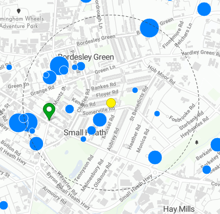
This object defines an accuracy of a feature. When hovering the feature, a circle with radius specified in given property is shown. See example below.
It's not possible to specify content, otherwise the syntax is identical to featureTitle.
type| Status | ||||
|---|---|---|---|---|
|
type identifier, always property - a dataset property
[property]value
name of the dataset property which contains the radius value in meters
dataSources
In this array, you can specify a list of data sources / licences for each dataset. This includes the licence holder's name, webpage, logo and the link to the licence itself. The unique list of data sources for each project can be displayed by clicking on:
...
Native datasets in this project are baskets, shops and clients. The other datasets were imported from different data dimensions. The datasets in orange were imported from the can-dim-dates dimension. Brown datasets are from a UK administrative units dimension. The dataset demography_postcode comes from a UK demography dimension. The h3Grid datasets are pink.
...
For geometryPoint and geometryPolygon datasets, a tooltip is shown on hover. The content is defined in dataset.properties.
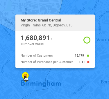
"My Store: Grand Central" is the featureTitle.
...
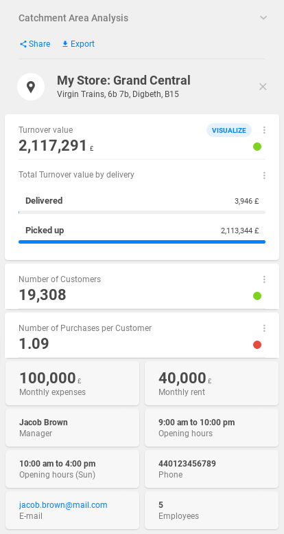
The content of dataset details is defined in dataset.properties.featureAttributes. The details are shown on the dashboard, right under the indicator list.
Feature accuracy
Hovering or clicking down on a feature with properties.featureAccuracy specified.